|
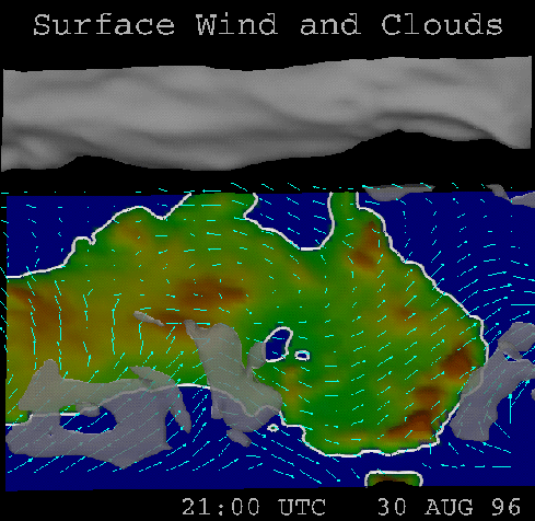
The visualisation involves a few simple stages. The first is a topographic map which provides a reference and context for the rest of the visualisation. This is achieved by generating a mesh showing the terrain, coloured by altitude, and a contour at sea-level to indicate the coast.
The next stage is to add the wind velocity visualisation. This was a straight-forward hedgehog vector visualisation, in the lowest horizontal plane possible. The hedgehogs are simple and easy to interpret, showing direction and magnitude.
The final stage is to display the relative humidity data by creating an isosurface at relative humidity of 1.0, the dew-point. This is then made slightly transparent so that the clouds don't obscure any of the wind information. The dew-point is the most useful point, as it is approximately the point where clouds begin to form in reality. Thus, an isosurface at the dew-point gives the approximate surface where clouds would form in reality, making it a good choice.